- New mixed consolidative and groundglass opacification identified within the medial right lower lobe in the region of the azygoesophageal recess, which obscures a previously seen enlarging pulmonary nodule in this location and likely represents evolving postablation changes.
- A 3 mm noncalcified nodule within the right middle lobe is mildly increased in size as compared with the prior study. Recommend attention at follow-up.
- Stable postsurgical changes related to prior right lower, left upper, and left lower lobe wedge resections.
- Cholelithiasis.

One of our goals this year was to explore more of the Pacific Northwest and continue collecting cancellation stamps for my National Park Passport. With another CT scan crossed off the list, we made our way up north for another road trip.

Oftentimes when people learn that I have cancer, they're shocked because I don't fit the image of how a cancer patient should look like. The majority of people believe that all cancer patients are bald, and frail. However, everyone doesn't lose his or her hair during treatment. Some drugs are more likely to cause hair loss, and different doses can cause anything from mild thinning to complete baldness.
I lost all my hair on three separate occasions with a high-dose Ifosamide chemotherapy regiment. Even though my hair eventually grew back, this extremely toxic drug left permanent damage to my nerves (peripheral neuropathy). This is a stark contrast to the targeted chemotherapy drug Afinitor®. I didn’t experience any hair loss, and the worst side effects from this medication were migraines, and canker sores.

Chemotherapy Treatment: Ifosfamide 3,200 mg.
September 2010.

Chemotherapy Treatment: Afinitor 5 mg.
August 2015.
Just because a cancer patient doesn’t fit the image of being bald and frail, it doesn’t mean that their illness is any less serious. All experiences with cancer are different, and with new medications continually be developed, we can receive treatment and maintain a high quality of life. Cancer is becoming more of a chronic illness, and is no longer synonymous with death.
It’s important to always choose your words carefully when speaking to a cancer patient. Each person has a different opinion and experience, and while you may mean well, it’s all too easy too to accidentally insult someone.

Below is a list of topics that may be wise to avoid. Hope this helps!
- Reasons why I have cancer.
- There is no answer that would ever justify why a person has cancer. No one deserves this, and unfairly assigning blame to the patient is never appropriate.
- Ways to cure cancer.
- Medical professionals have devoted their lives to scientific medicine. Please do not suggest a crazy diet/treatment from the Internet.
- Unsolicited religious advice.
- Thank you for your well-meaning wishes, but if I need religious or spiritual guidance, I will seek it out myself.
- Cancer patient stereotypes.
- Age. Cancer can occur at any age; it doesn’t happen in just the middle aged and elderly.
- Treatment Plan. There are more than 200 types of cancers. Each treatment plan is individualized for the patient’s specific disease. No treatment plan is the same.
- Appearances. Not everyone is bald, and sickly thin.
- Survivorship. Do not suggest that only individuals strong enough to endure treatment are able to overcome the odds and beat cancer. There are many people that fought with all their strength, and yet succumbed to their disease.
Castle Crags State Park
Castella, CA
Vista Point Trail

The Castle Crags are made of granite that cooled slowly deep within the earth. Once the granite was exposed to the elements, water and ice caused fractures in the rock, creating the castle-like features.

The Gray Rocks are mainly greenstone and are a detached portion of the Copley Formation.

Mount Shasta was formed 530,000 years ago, and is the youngest of the geologic features. It last erupted in 1786, but is considered dormant for now.
Mossbrae Falls
Dunsmuir, CA
Note: It is highly discouraged to visit Mossbrae Falls due to the danger of walking on and along active railroad tracks. If you do decide to go, proceed with extreme caution.

Head down Dunsmuir Ave. and walk into the stone and iron archway labeled "Shasta Retreat." Don't park inside. Citations are issued to people who park inside.

Walk pass the wooden address signs.

Hike a mile along the Union Pacific Railroad.

"I Choo Choo Choose You."

If you've reach the rail bridge, you've gone too far.

View of the Sacramento River below.

Back we go in search of Mossbrae Falls.

The waterfalls are located on the right, through the trees, before the rock labeled "Mossbrae Falls".

We found it!
Mossbrae Falls is one of the most scenic waterfalls in California. The cascade of falls are fed by springs, and course down the moss-covered canyon wall into the Sacramento River.

Mossbrae Falls is an impressive 50 feet high, and 200 feet wide!
Shasta–Trinity National Forest
Redding, CA
Jot Dean Cave

Enter if you dare.

Jot Dean Cave is not a developed cave, and requires scrambling down into the the pile of loose rocks, and sharp boulders. Inside is an ice wall 6 inches thick, 8 feet wide, 20 feet wide, varying from opaque white to crystal clear.
Medicine Lake

Medicine Lake is located in the caldera of Medicine Lake Volcano. The lake measures 4.3 by 7.5 miles.

The lake offers many activities such as camping, fishing, and hiking. It was also a wonderful place to rest and soak our feet.
Lava Beds National Monument
Tulelake, CA

Lava Beds National Monument lies north of Medicine Lake Volcano. During the last 500,000 years, this shield volcano's many eruptions spewed lava, gases, and cinders eventually cooling to form many fantastic underground caves.
Mammoth Crater

One of the most extensive eruptions on the volcano was from Mammoth Crater, an enormous basalt flow that covered over 100 square miles, making up seventy percent of the monument.

The remarkable amount of lava that poured from the earth here created hundreds of lava tube caves, making it the highest known concentration of lava tube caves in the continental United States.
Catacombs
(Length 6,903 ft.)
(Length 6,903 ft.)
Note: Before entering the Catacombs, purchase a cave map, and wear proper cave safety gear (helmet, knee pads, and gloves). The ranger we spoke to gave us wrong information!

With a total traverse length of 6,903 feet, the Catacombs is the longest cave in the monument, and was for a while the longest known single entrance cave in California.

The cave was discovered on March 2, 1918 by J.D. Howard after seeking shelter from a blizzard by descending into a collapse sink.

The many branches and alcoves reminded him of burial chambers beneath the city of Rome that he had read about, so he named it Catacombs.

The cave is two parallel tubes almost all the way, with some braided complexity and many short, plugged branches.

Which way should we go? Right or left?

This very long cave is easily entered but gradually increases in difficulty. It's possible to walk upright for approximately 800 feet to the stairway, after which the ceiling rarely exceeds 3 feet.

A few places exist where the ceiling height is less than 12 inches!

Watch out for those "lavacicles" and "sharktooth stalactites."
Skull Cave
(Length 580 ft.)
(Length 580 ft.)

Skull Cave was named by E.L. Hopkins after a large accumulation of bones, including those of two humans, found at the bottom of the pit.

It is a multilevel segment of the Modoc Lava Tube System, a 10 mile long system.

The wide open feel of Skull Cave was an excellent choice after the tight closed-in spaces of the Catacombs.

The cave is a remnant of three very large lava tubes, one on top of the other.

The multilevels allow cold winter air to be trapped inside and create a year-round ice floor on the lower level.

Down the metal stairway we go.

The floor of the Ice Chamber has been part of Skull Cave's environment for hundreds of years. Historic accounts indicate that its clarity was pristine enough to see several feet into the floor. Over time, the buildup of dust and dirt on the ice surface has diminished its quality and clarity.
Schonchin Butte
(0.7 miles; 500 feet elevation gain)

Schonchin Butte is one of many eruption sites from the Medicine Lake Volcano.

Medicine Lake Volcano is the single most massive mountain in the Pacific Northwest and home to over two hundred cones, craters, and other eruptive vents.

"Only you can prevent forest fires."

Much of what is found in the monument is a type of rock called basalt, which erupts in different forms. All of these eruptions were born of the same material, but resulted in many different formations.

Two vast geologic provinces intersect on the horizon. To the left lies the Cascade Range, a volcanic arc home to dozens of volcanoes. To the right is the Basin and Range province, a series of peaks and valleys that begins here and extends east to the Rocky Mountains.
Devils Homestead

Devils Homestead Flow is 10,500 years old.

Although the landscape may seem desolate, the cooled lava is home to life. Within a few years after the lava cools, lichen appear and break down the newly formed rocks, allowing vegetation to take hold.
Tule Lake National Wildlife Refuge

For more than 10,000 years, Native Americans camped along the lakeshore to hunt, fish, and harvest a variety of marsh plants.

Tule Lake once covered 100,000 acres and was described as the "Everglades of the West." However, human activity has reduced the lake to 1/10 its original size.
Klamath Basin National Wildlife Refuges
Tulelake, CA

The Klamath Basin Refuge Complex consists of six refuges, each supporting a variety of different habitats and diverse and abundant populations of resident and migratory birds. More than 350 species having been observed in the Klamath Basin alone!

"I can fly higher than an eagle, 'cause you are the wind beneath my wings."

Each spring, more than a million birds migrate through the Klamath Basin. In April and May, many songbirds, water birds, and shorebirds arrive. Some remain to nest, while others stay only long enough to rest and build fat reserves for their continuing journey north.

Fall migration begins with the arrival of Northern Pintails and White-fronted Geese. By November, more than one million ducks, geese, and swans fill the skies over the refuges.
Crater Lake National Park
Oregon

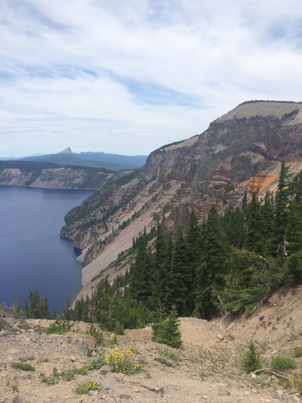
Crater Lake is a caldera lake famous for its deep blue color and water clarity. With a depth of 1,978 feet, it is the deepest lake in the United States, the second deepest in North America, and the ninth deepest lake in the world.
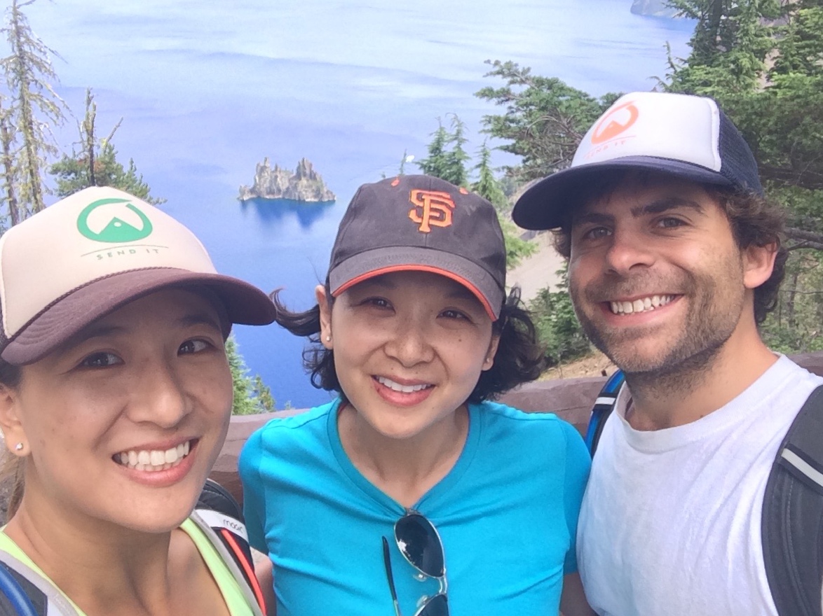
Phantom Ship Overlook

Phantom Ship is the dark, jagged island just offshore that resembles the image of a ghostly ship with tall masts and drooping sails. These rock spires are remnants of an ancient volcanic cone, and is the oldest rock displayed in the Crater Lake basin at over 400,000 years old.

Wizard Island.
Pumice Castle, shaped like the battlements of a castle, formed when pumice and other lavas welded together at high temperatures. A hardened base has kept Pumice Castle intact as softer materials have eroded away.
Mount Scott
(5 miles; 3 hours; 1,200 ft. elevation gain)
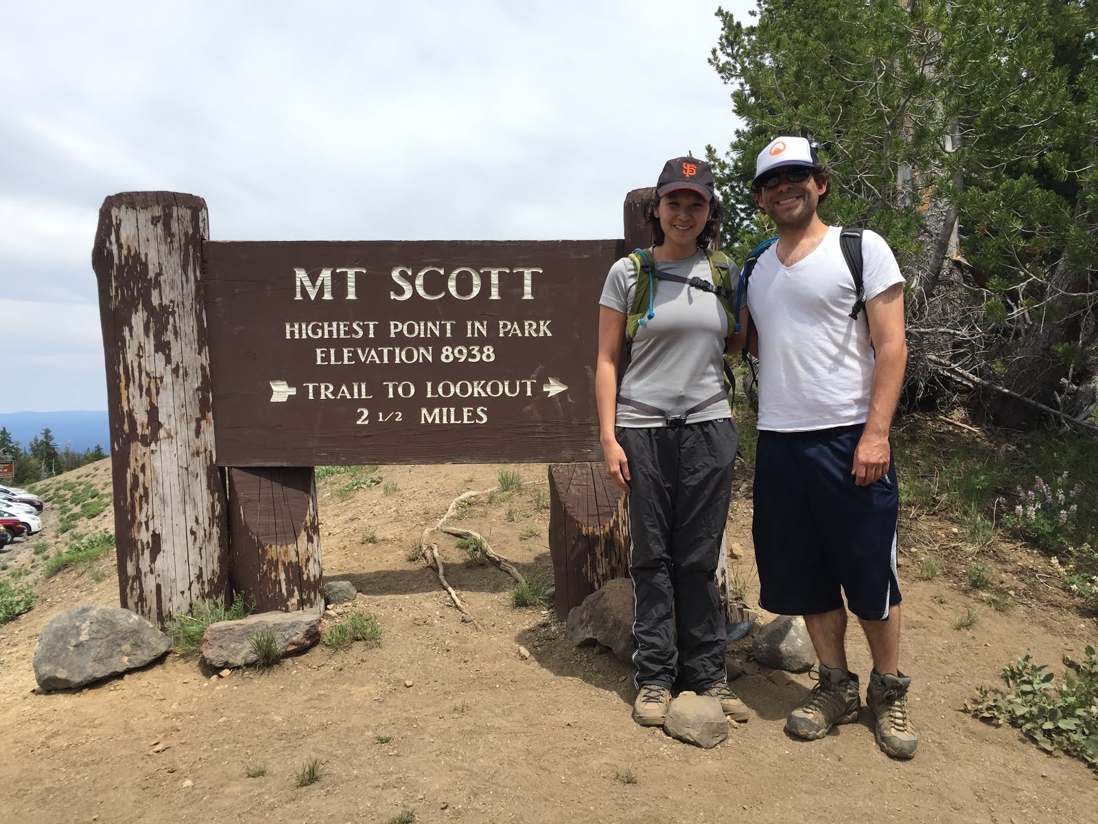
Mount Scott is the highest point in Crater Lake National Park at an elevation of 8,938 feet.
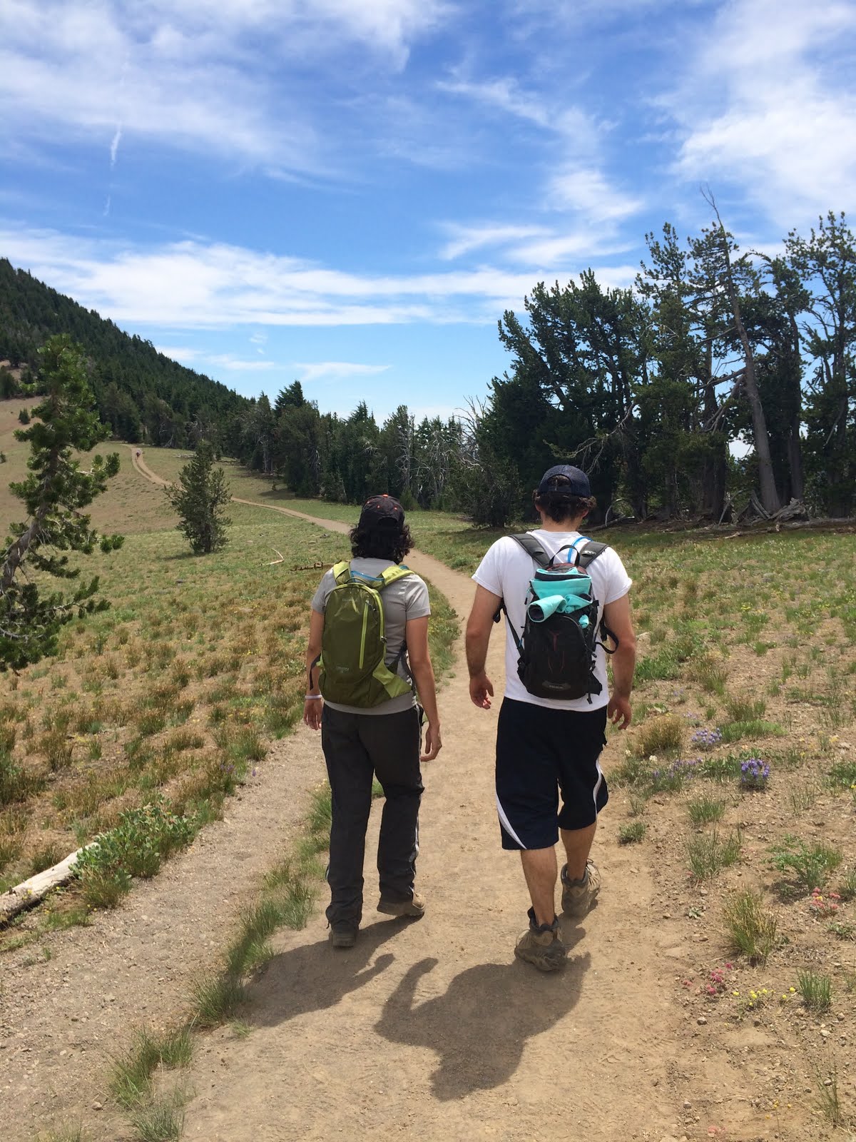
Initially, the trail traverses a fairly open expanse of pumice, and then climbs through a forest of primarily mountain hemlock on the west and southwest slope.

Oh my!

Making our way up the switchbacks.

On high ridges, look for pikas and marmots among the rocks, and birds of prey above. Also watch out for snowballs!

Follow the ridge line to the summit, and end at a fire lookout.

Mount Mazama erupted 7,700 years ago, leaving a deep basin in the place where the mountain peak once stood. Centuries of rain and snow filled the basin, forming Crater Lake; a deep blue lake whose water are of unmatched color and clarity.

Crater Lake has a depth of 1,943 feet, and holds 4.9 trillion gallons of water.

There are no rivers flowing into or out of the Crater Lake. The evaporation is compensated entirely by rain and snow.

Enjoying the awe-inspiring views of the entire landscape around Crater Lake.

♥
Cleetwood Cove Trail
(2.2 miles; 1.5 hours; 700 ft. elevation gain, 11% grade)

Due to the extreme instability of the steep walls of the caldera surrounding Crater Lake, Cleetwood Cove Trail is the only access to the lake shore.

The softer rock layer easily erodes away by water and wind, causing the harder rock layer above to collapse and eventually cause rockfall. Do not short cut switchbacks in the trail. It can causes serious injury to others below you.

Research on the lake floor reveals thick mats of bacteria thriving in the absence of light. Additionally, thick bands of moss ring the walls at depths over 400 feet. Much remains to be learned; only two percent of the lake bottom has been explored.

I have a good idea of where that thriving bacteria came from.
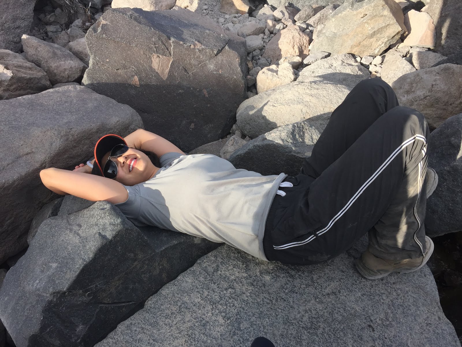
Reenergizing for the hike back up.

The return route is strenuous, with a steep grade made even more difficult by the high altitude. It's equivalent to walking up 65 flights of stairs, and should not be attempted by anyone with heart, breathing or walking problems.
Mazama Village Campground (Area G)

The Mazama Village Camper Store had a nice selection of local beers. My sister was caught red-handed.

Relaxing by the campfire after a long day of hiking.

Stunning.
Pinnacles
(1 mile; 30 minutes)

The Pinnacles are needle-like formations of rock that were formed under sheets of volcanic pumice sculpted through thousands of years of erosion.

Pinnacle Valley.

Amazing views of volcanic spires in canyon walls. Use caution near cliffs.

On our way out, we had to stop one last time to admire the views.
Until next time, Crater Lake.